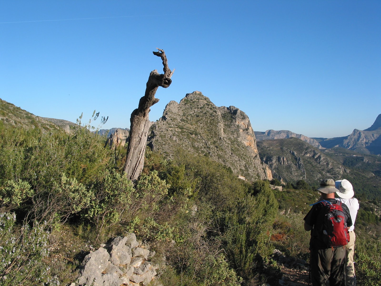
BOLULLA - MORRO BLAU CIRCUIT

An arduous walk that starts at Bolulla with a steep climb up a surfaced road offering fine view of the village. A little known old mule path continues the climb up to Foia Selles where spectacular views can be enjoyed. A short decent into the Barranco del Negra offers a little respite before climbing steeply once again to arrive just below the summit of Morro Blau.

A short track walk followed by a no path, find your own way down, to below the Serra del Raco Roig. Fine views of Bollua Castle can be enjoyed from the path to El Collada. The walk ends with a relaxing walk down to Bolulla on sections of old mule paths. 


DISTANCE 14km. – WALKING TIME 4¼ hrs. -  ASCENT  893mtrs - Grade S

Click here for RELIVE view of walk

Click here for map and directions.  or  Click here for just map
Click here for GPS track download

SERRELLA CASTLE - EXTENDED


This strenuous but exciting walk has very little flat sections. The ups and downs are often very steep. Some path finding skills required as paths are overgrown in places and can be badly eroded. The normal approach to El Castlett (Serrella Castle) is from the North at Castell de Castells. This more dramatic approach is from the South near Guadalest. The ascent of the rugged Borranco de les Coves begins on the West side with a good path. A rock scramble brings us to the east side. This crossing is made more exciting when there is flowing water. The path continues ascending as it heads into the spectacular widening Canal of Malla de Lloup.  About half way up the Canal we exit by zig zagings up the east side, affording great views of the Canal as we gain height. The very steep track leading up to the pinnacle of El Castelet can be daunting but good views offer excuses for many rest stops. The scramble up to the castle ruins (not for those suffering from vertigo) is rewarded with stunning 360-degree views. A steep decent on a partially surfaced road followed by a nice ramble on an abandoned track to return to the Barranco de las Coves where we retrace our steps back to the start.


DISTANCE  11km. WALKING TIME  3 3/4 hrs. ASCENT 768mtrs. GRADE  S/Scr

Costa Blanca Mountain Way

The original Costa Blanca Mountain Way was proposed in 1990 to mark the fifth anniversary of the
 Costa Blanca Mountain Walkers.
Completion of the five sections (110km.) in consecutive days  entitles the walker to be entered on the roll of compañeros by contacting the group secretary and filling out route sheet also available from CBMW.
The route has been updated to reflect newly found paths and alternatives to busier roads.

WALK DESCRIPTIONS AND MAPS                                 GPS TRACKS
Day 1 - Villalonga to Vall de Ebo                                                   Day 1
Day 2 - Vall de Ebo to Campell                                                     Day 2
Day 3 - Campell to Castell de Castells                                          Day 3
Day 4 - Castell de Castells to Confredes                                       Day 4
Day 5 - Confredes to Benifato                                                       Day 5

Click here for Google map to start


Pinos Marnes Barranco del Baron Sella de Cau Circuit

The lovely start to this walk is through a peaceful barranco to the “Refugio Marnes”.  Where a quick stop to admire the mules can be enjoyed before a short climb followed by a long flattish walk to reach the impressive Barranco del Baron. The barranco ends at a very picturesque area with an old well and ruin. This is followed by an uphill stretch which requires some path finding skills to arrive at a very pleasant grassy track. Now there is an easy walk through some interesting vineyards before reaching a paved track which traverses a cultivated valley. This is followed by a steep climb up to the saddle below Cau. Then short tracks and a long path down to the CV749 and car(s). The views are excellent and the wildflowers in spring and early summer make this a very pleasant walk.

DISTANCE 11.8km.WALKING TIME 3 ½ hrs.ASCENT 544mtrs. GRADE Moderate

Click here for map and description of walk.  or  Click here for just map
Click here for GPS track
Google map to start

FIG TREE WALK


Good leg stretcher on mainly forestry tracks with splendid views of Alfaro to the north and Cordilleras to the south. Interesting ruins.

DISTANCE 11.8km WALKING TIME 3h 10min. ASCENT 580mtrs.  GRADE Moderate

Click here for map and directions  or  Click here for just map
Click here for GPS track
Google map to start

CASTELL FAMORCA CIRCUIT

 
Starting in the picturesque village of Castell de Castells, up to ridge overlooking Malla de llop canal, down to the village of Famorca and back to castells via very good paths and remote tracks, another great Sierra de Serrella walk.


DISTANCE  20km -  WALKING TIME 5 ½ hrs. -  ASCENT 784mtrs. -  GRADE VS

Click here for directions and map  or  Click here for just map
Click here for GPS track
Click here for Google map to start

CASTELL GRANADELLA CIRCUIT


This is an easy walk although there are some very steep uphill sections. The costal path is a little exposed in places but a couple of chains have been placed to aid the walker. It starts at Cumbre Del Sol at an elevation of 190 meters with a pleasant flat track walk before descending on a path to reach the beach of Cala Granadella. A very stiff uphill walk is rewarded by a beautiful coastal path to the ruins of Castell Granadella. The ruins of this horseshoe shaped building, which was once part of the Valencia Costal defence, date back to 1739. It was ruined by the English during the Napoleonic war. From the Castell there is another steep climb (with lovely wild flowers in spring) to the Mirador de Llevant. A stop to admire the views is followed by an easy track walk back to the start.
   
  DISTANCE 8.5km. WALKING TIME 2 ½ hrs. ASCENT 378mtrs. GRADE E

Click here for map and directions  or  Click here for just map
Click here for GPS track
Google map to start

Castell de Castells Circuit


This is an ideal Sunday morning walk all on very good tracks and paths. It starts fairly steeply uphill but after that it meanders gently cross country and back to Castells. Our route passes Font de la Retura a very pleasant spot before crossing the CV752 to reach an interesting ruin which is bound to cause discussion.

DISTANCE 10.4km –  WALKING TIME 2 ¾ hrs  – ASCENT 387mtrs. – GRADE E

Click here for Map and directions  or  Click here for just map
Click here for GPS track
Click here for Google map to start

Barranco de Malafi - Alfaro Circuit


The walk starts with a vaguely marked ascent to Punta d’Alfaro followed by a long pleasant ridge walk and short climb to the summit of Alfaro.This high spot offers wonderfull views of the Sierra Serrella  before descending by old tracks which lead very steeply down to Barranco Malafi. Barranco Malafi  is the grandiose and remote gully formed by the, generally dry, river Malafi.  Superb wild flowers in spring and early summer. Bird songs accompany the walker often nightingales and sometimes eagles can be seen.

Preferably a GPS or at least a compass would greatly aide in following our notes.

DISTANCE 16.3km. WALKING TIME 5 ¼ hrs. ASCENT  731mtrs. GRADE Hard

Click here for map and insrtuctions  or  Click here for just map
Click here for GPS track
Click here for Google map to start

AITANA - Passet del Golero

This circular walk is very hard to beat for its variety of scenery. Although classified as hard, due to its length, it is all on good paths and tracks. It starts with a steep climb up to the Paso Contador. Once this has been achieved the rest of the walk is fairly gentle. A lovely stroll along the east side of the peaceful Arc Valley reaches the impressive zigzag of the Passet de Golero. Before descending take advantage of a rocky lookout which makes an ideal rest stop. Although the descent is not very long this old path should be taken slowly to admire the spectacular views. A long track walk, made pleasant with very varied scenery, reaches the old Farmhouse ‘La Carrasca’. The scenery changes once more, offering glimpses of the Buddhist Colony down in the valley before passing through the narrow pass of the Mas de Sanxet and below the impressive cliffs known as the ‘Rooms of God’. A long but easy stretch of path returns to the outward route and back to the start.
The start from Almaseras is our choice but parking space makes this a poor choice for large groups. Plenty of parking at Rincon de Pepe start.

DISTANCE 15.3km.  WALKING TIME  41/2 hrs.ASCENT  803mtrs. Grade  S

Click here for RELIVE view of walk
Click here for directions from Rincon de Pepe  or  Click here for just map
GPS track for above
Click here for directions to Raco de Pepe
Click here for directions from Almaseras  or  Click here for just map
Click here for GPS track

AROUND SEGARIA

A very Pleasant walk around this rugged mountain which includes the summit of the lowest of three peaks (the tip of the Red Indians nose).


DISTANCE 13 km WALKING TIME  3 ¾ hrs. ASCENT 682m  GRADE  S/B

Click here for map and directions.  or  Click here for just map
Click here for GPS track

VALL DE EBO - Albert's peak

 The length of this walk, combined with the restaurants of Vall d’Ebo, make it a good candidate for walk followed by lunch. It is a circular walk which starts by following the river bed eastwards (a nice warm up) before a moderate climb up to the Refugio La Figuereta. From here a nice path and a gentle climb leads to the cull below Albert’s peak .A short steep optional climb to the summit is rewarded by a peaceful place to rest and admire the views. The route back to Vall d’Ebo passes some old stone walls and, with a very short detour, a small covered well (or nevara?)  before starting to descend. The descent, gentle at first, passes some beehives (silence recommended) before reaching a very deep sinkhole which is worth a look. A steep impressive Mozarabic path leads back down to the riverbed and on to lunch.

DISTANCE  9.3km.WALKING TIME  2 ¾ hrs. ASCENT  412Mtrs.GRADE  Medium

Click here for RELIVE view of walk
Click here for map and directions  or  Click here for just map
Click here for GPS track
Click here for Google map to start

TARBENA - Font d'Olbis circuit


A delightful walk with constantly changing scenery along generally easy tracks and paths with a finish looking over Paso Tancat – a wonderful gorge. Optional 2.2km. return trip to Castle dels Moros.


Click here for map and directions  or  Click here for just map
Click here for GPS track

Aitana Ridge from Font Moli

Font Moli  Ondara is a well-watered picturesque area with shady trees, excellent water, and a picnic area with tables and benches.

The walk up to the narrow pass of the FAT MAN'S AGONY provides superb panoramic views and passes two Neveras (ice pits). It has the added interest of an exciting scramble through the pass which, once negotiated, opens up different panoramic views to the South. Crossing the ridge offers all the rewards of being on top of the highest mountain range in the Costa Blanca.

The walk is mainly on good tracks and mountain paths. The scramble through the pass requires some agility.(see video)
Being high it can be cold and snowy in winter. Isolated shade in summer. Some mud soon after rain.

DISTANCE 15km. -  WALKING TIME  5 hrs. -  ASCENT  1073mtrs. - GRADE  VS

Click here for RELIVE view of walk
Click here for map and directions  or Click here for just map
Click here for GPS track
Google map to start

Carrascal de Parcent Ridge Circuit

Good walk on well marked good paths starting with a 2 hour uphill, nice ridge walk,
descent to Coll de Rates where an excellent strudel can be had at restaurant at col,
followed by downhill paths back to Parcent.


DISTANCE 14.5km. - WALK TIME  4hrs. - ASCENT  863 Mtrs. - Grade  Meduim 

Click here for map and directions  or  Click here for just map
Click here for GPS track
Click here for Google map to start

Ponoch Col Circuit

Very nice shorter (2 1/2 hrs walking time) walk from 4km behind Font Moli in Finistrat, up to
Puig Campana circuit path, continuing up to Collado del Llamp, along the Collado de
Sacarest with its impressive views of the Castellets and returning to Realet Dalt.
A side trip up Monte Ponoch would add a further hour and increase difficulty from easy to
medium.


DISTANCE 9km. WALKING TIME 2 ½ hrs ASCENT 447mtrs. GRADE Easy

Click here for photos
Click here for map and directions  or  Click here for just map
Click here for GPS track

SERRELLA - Famorca Loop

The walk starts at the delightful village of Famorca. After a short distance on tracks we pick up a good path which climbs slowly up to the top of the north  ridge of the impressive Malla del Llop canal. From here we walk a short way towards the Penya del Castellet before starting to descend on a zig zagging track towards Castell de Castells. After walking a couple of kilometers along this pleasant track we pick up a path which leads us back up and through some impressive rock formations to the lovely cool spot of the Font de l’Olvis. Our descent continues passing some interesting caves before arriving back at Famorca.

DISTANCE  12.3km. WALKING TIME  3h 45min.ASCENT 540mtrs.GRADE Medium

Click here for map and directions  or  Click here for just map
Click here for GPS track
Click here for Google map to start

SERRELLA - Facheca - Famorca Circuit

This is a circular walk that starts on the North side or the Sierra de Serrella with a steep climb up to Font Roja, situated at the head of the picturesque Barranco Hondo , then crosses to the south side and passes below the summit of Pla de la Casa to reach and traverse the head of the Barranco del Moro with splendid views down to the village of Facheca. You then continue on the south side passing below the Pico de Serrella before the final climb up to the Malla del Llop ridge with magnificent views in all directions. Traverse the ridge back to the summit of Pico de Serrella before descending a little to an ancient snow well. Follow  an old mule path which zig zags steeply down the mountain back to the quaint village of  Famorca. The walk ends with a good leg stretcher along a pleasant, tranquil track back to Facheca. This final  2 kilometer stretch can be eliminated if a car is spotted at Famorca before starting the walk.

DISTANCE 14.4km.  -  WALKING TIME 4 ½ hrs. -  ASCENT 808 mtrs. -  Grade  S

Click here for map and directions  or  Click here for just map
Click here for GPS track
Click here for Google map to start

Fonts de Algar circuit


No mountaintops or ridges are gained on this pleasant walk in the Algar valley but the scenery is spectacular nevertheless. Although a fairly low level walk, it begins with a steep 1.2 km / 150 mtr ascent on a surfaced road. This can be avoided by shortening the walk and driving up this first kilometer where parking for 5-6 cars can be found. After this arduous start has been overcome, our route meanders along the south side of the valley below the Penya Severino, passing a ruin beautifully situated on a little spur. The optional side trip to the spectacular Paso de los Bandoleros should not be missed. The path to this peaceful spot is easy to follow but can be a little overgrown. The reward is a great place for lunch. The return route is on the north side of the valley on mainly good tracks, passing through orange, nespor and almond groves.
Click here for instructions  or Click here for just map
Click here for GPS track
Click here for Google map to start

Guadalest Resevoir Circuit

A pleasant Sunday walk, mainly on paved quiet roads with one short stretch of unpaved track which can be muddy after rain.
2015 CAUTION : Do not leave valuables in car at this car park.


Click here for map and instructions  or  Click here for just map
Click here for GPS track


DISTANCE  9.4km  - WALKING TIME 2 ½hrs -  ASCENT n/a -  GRADE E

Aitana Range Circuit from Partagas

The walk up to the narrow pass of the FAT MAN'S AGONY provides superb panoramic views and passes two Neveras (ice pits). It has the added interest of an exciting scramble through the pass which, once negotiated, opens up different panoramic views to the South. Crossing the ridge offers all the rewards of being on top of the highest mountain range in the Costa Blanca.
The walk is mainly on good tracks and mountain paths. The scramble through the pass requires some agility.
Being high it can be cold and snowy in winter. Isolated shade in summer. Some mud soon after rain.


DISTANCE 12.1km WALKING TIME 4 hrs. ASCENT 690 Mtrs. GRADE Medium

Click here for video
Click here for GPS track of walk
Click here for map and directions  or  Click here for just map
Google map to start

AITANA - Benifato Castle from Font Moli

This is a long walk on the lower north side of the Aitana range. It is mainly on very good tracks which allows you to soak in the beautiful scenery. It commences with a pleasant  walk to Partagas with amazing views of Guadalest. Other highlights are passing through an interesting rock slide, a beautiful hidden valley and a scramble up to castle ruins. There are a few stretches on paved roads but the scenery relieves the tedium. Save this walk for a clear day.

DISTANCE  16.5km. - WALKING TIME  5hours.-  ASCENT 812 mtrs.-  GRADE  S

Click here for map and directions  or  Click here for just map
Click here for GPS track
Google map to start

Pamela's Pedreguer Paseo

A maze of well established paths created under the guidance of a previous mayor of Pedreguer
with lots of interesting sites (castle, fonts, ruins) and great views. With map and compass, this walk can be varied to suit walker’s abilities.


WALK STATS: DISTANCE 12.3km. – WALKING TIME 3 ¾  hrs. -  ASCENT  590mtrs - Grade M

VAL DE LAUGAR -CAVALL VERDE RIDGE-DOS FUENTES

Caballo Verde Ridge : often referred to as the "Caball Vert" ridge. According to the map the real name is the Sierra del Penyo Roig (Range of the red rock) The Caballo Verde is actually the eastern most part of this 6km long ridge); also called the "Serra del Penyal de Laguart".This walk takes you over 3.2Km. of the ridge, then along Mozarabic paths, through cherry tree plantations (beautiful whenin flower in early to mid April), passing interesting hilltop restaurant and back to Benimaurell.A strenuous walk which can be shortened by skipping summit of Vaballo Verde.


DISTANCE 13.2km. WALKING TIME 4hrs. ASCENT 569mtrs. GRADE medium


Click here for pictures
Click here for map and directions  or  Click here for just map
Click here for GPS track
Google map to start

Rotova Circuit

In 2011 a fire burnt a large area of this walk. Although the burnt trees are sad to see the walk was not ruined as the fire exposed the rugged terrain and created a dramatic effect. A very pleasant path leads up to the Castel which was built on a pinnacle of rock that seems to have been placed ideally for the purpose. The Castel is viewed from many different angles as the walk progresses. After exploring the Castel ruins there is a gentle climb up to the lookout on Penal De L’Estruca. Stop to admire the views before tackling the more demanding ascent to reach the Alt De Sagueiles, a great place for lunch. The return to the start is downhill all the way.

Most of the signposts were destroyed by the fire although many of the direction fingers are still intact and lying on the ground. Hopefully these will be repaired in the near future and with this in mind signs have been included in the instructions.


DISTANCE  9.6km. WALKING TIME  3hours. ASCENT  557meters. GRADE  Medium

Click here for RELIVE view of walk
Click here for map and directions  or  Click here for just map
Click here for GPS track
Click here for video

LA NUCIA AREA - Puig East

This walk starts in the valleys below the impressive Puig Campana. Then it climbs to link with part of the well known circuit of the Puig Campana but going anti-clockwise reveals different views. Decends again to a valley with grand views of Ponoch, circuits the Tossal del Grau and follows the charming Barranco del LLiriret back to the start.
The same walk can be done with an easier start from Amanellos
(see Puig East from Amanellos)

Click here for map and directions
Click here for GPS track download


       DISTANCE 9.7km -  WALKING TIME 3hrs. –  ASCENT 585mtrs.- GRADE Medium

SERRELLA - Pla de la Casa circuit from the South

It would be hard to surpass the scenery on this walk but it comes at a price.

It begins with a nice gentle walk along the pleasant Cami de la Ombria on the south side of the Barranco del Monesillo.
After crossing to the north side of the Barranco the going gets tougher with a steep, long ascent to El Collado. The traverse of the Raco del Corb is a little easier and is rewarded by spectacular views down the Barranco Del Moro. Now another stiff climb on rough paths to reach the flat area of the Pla del la Casa. Then a short scramble to the trig point at the top with its cross and visitors’ book. The view alone is worth the effort. The decent to the Collado d’en Borrell is steep but it is followed by a pleasant walk through pine woods. A nice respite before passing through the Contador Bardals to begin the very steep decent, on rough paths, back to the car. The actual walking time is some 5 hours but roughness and steepness of paths necessitates, and stunning views warrant, frequent stops. So allow plenty of time.

DISTANCE 11km. WALKING TIME  4¼hrs. ASCENT 659mtrs.GRADE Difficult
Click here for photos
Click here for map and directions
Click here for GPS track download

AITANA - EXTENDED SANXET CIRCUIT

A fairly long circular walk starting with a steep climb on good paths up the Barranco de Galabdar below the escarpments of Sanxet. Then heads west levelling out until the short but impressive zigzag up the Passet de Golero. Here there is a rocky lookout which makes an ideal lunch stop. Another steep climb to reach the peaceful Arc Valley and the Paso Contador with spectacular views. From here it is downhill (steeply in places) all the way back to the previously spotted car, which will be used to ferry drivers up the hill to the Casa de Dios.

Although this walk can be easily walked as a complete circuit we shorten it, whenever possible, by spotting a car which avoids an uphill walk on a surfaced road.

DISTANCE 13.6km. WALKING TIME 5hrs. ASCENT 700mtrs GRADE S

Click here for map and instructions
Click here for GPS track

BOLULLA AREA CIRCUIT

This is a beautiful walk which combines the old mule paths from Bolulla (that supplied the Castle and areas beyond) with a higher level circular walk. Both of these shorter walks can be done separately.

While surfaced roads reach almost to the col below the Castle it is well worth tracing the old path which is now cut by tracks and roads but there are still four well defined sections of mule path to enjoy and the intervening stretches of road are short.
At the col below the castle our route follows above a barranco until reaching a peaceful fertile valley and the return to the col has fine views of the Arc dels Xaeguet and the Sierra de Aixorta.
The return from Point A to the bar Era includes tracks and a mule path through pine woods.


-WALK A: DISTANCE 6.5kmWALKING TIME 2hrs.ASCENT 350mtrs.GRADE E


-WALK B :DISTANCE 7.6kmWALKING TIME 2 ½hrs.ASCENT 330mtrs. GRADE E


-WALK C:DISTANCE14.1km-WALKING TIME 4 ½hrs.ASCENT702mtrs.GRADE S

All three options are included on the same writeup. A separate GPS track is available for each option.
  Click here for instructions
Click here to download GPS track for:
                                         Ancient Route option   6.5km. 2hrs
                                         Raco Roig option         7.6km 2 1/2 hrs
                                         Both walks                    14.1km 4 1/2 hrs.
Click here for video

PINOS - SELLA de CAU CIRCUIT


A very pleasant walk in fairly level, upland karst type scenery, including an old mule path through a barranco, short stretches of track, and long "improved" goat paths among undulating hills with mountains in the background. A sharp climb to the saddle below Cau from where there is the opportunity of a short climb to its summit. Then continuing along short tracks and a long path down to the CV749 and car(s). The views are excellent and the wildflowers in spring and early summer fascinating. For those making a long day of it a visit to the Iris Garden in the middle of the walk is rewarding in April to June when it is at its best. (Opens April 1st). A possible short cut is described at the end.

DISTANCE  9km - WALKING TIME 2 ½hrs. -  ASCENT  360mtrs. - GRADE  Medium

Click here for map and instructions
Click here for GPS track
Google map to start


SERRELLA - Pla de la Casa from the South

Choose a clear day and the views are stupendous, climb amongst shear jagged cliffs and spires, look over precipices with the valleys spread below like a map, discover a verdant hidden valley, peer 13 meters down one of the largest neveras in all these mountains, write your name in the book on the summit and visit Font Roja with its cold water and mule track down to Quatretondeta. The penalties are some grueling climbs and descents on very rough paths often amongst scree. But interspersed with paths through pinewoods and good forestry tracks which provide welcome variety. Not for vertigo sufferers. The actual walking time is some 4hours 20 mins but roughness and steepness of paths necessitates, and stunning views warrant, frequent stops. So allow plenty of time.

DISTANCE 7km. WALKING TIME 4hrs. ASCENT 625mtrs. GRADE Strenuous

Click here for map and instructions

Click here for GPS track
Click here for slideshow


EL CABEZA D'ORO

A circuit around the southern part of this impressive Sierra, which at 1209 meters high is a contorted ridge of rock thrust up some 800 meters above tie surrounding land. It runs North to South and has shear, frowning cliffs on its West side interspersed by deep gullies and barrancos. The walk starts with 35 minutes of fairly gentle ascent along a good track beneath high cliffs, followed by a stiff 200-meter ascent up a path up the barranco Raco Seva. This has occasional shade, it might prove slippery on a descent. This is followed by a gentler climb through pinewoods to Polset, (950m) with its ruin and nevera and excellent views. From here the ascent of Cabecó d’Or (1209 m) takes about 90mins return and is not included in this circuit. From Polset the descent, via a good mule track, is fairly easy with delightful views of cliffs, bluffs, and the countryside to Alicante and the Mediterranean Sea. When Pla de Cabecó is reached some may welcome the opportunity, if a car has been pre positioned, of avoiding the final steep 130 m ascent to the Cuevas del Canelobre. The Cave is well worth a visit, but involves a fee and takes an hour.


-WITH SUMMIT:     DISTANCE 10.2km - WALKING TIME  3 ¾ hrs – ASCENT 842mtrs.- GRADE  Medium
-WITHOUT SUMMIT: DISTANCE 8.5km  - WALKING TIME  2 ¾ hrs - ASCENT 535mtrs. – GRADE  Easy

Click here for pictures

BERNIA

A 4km. limestone ridge running west to east from the Algar Valley to Calpe.

Geography and History

The Sierra de Bernia form the background for Altea and Albir and afford hikers of all levels interesting walks.The Bernia circuit and Fort Bernia are fairly easy walks offering incredable views on both sides.
Fort Bernia was built during the reign of Philip II of Spain to control and suppress the Moorish uprisings, which were commonplace in these mountains. When the Moors left, fort Bérina was abandoned.
The Bernia Ridge rises from the sea from the Moro de Toix between the resorts of Altea and Calpe. The first part of this ridge is known as the Toix ridge but may be marked on the map as "MAR Y VILLA". The ridge then descends to become the Mascarat Gorge through which the main road, the motorway and the railway all pass. The ridge then rises as a great cliff eventually easing to the first summit at the eastern end. From here the ridge continues seen as a very jagged skyline from both the north and south sides for aproximately four kilometers. The highest point lies well to the western end at 1129 metres. It is not possible to walk continuously along this ridge though sections of it are walkable, but do involve a certain amount of scrambling. Apart from the actual ridge there are popular walks both round it and through it. It can be approached from either the Altea (south) side or, more commonly, from the north side which is the natural starting point at the Bernia restaurant at a height of approximately 650 metres.The complete ridge is not a walk but a serious and exposed scramble. Even so it is not possible to remain on the crest and a rope is essential at the point where 'FIN' is painted on the rock in order to abseil. Although the ridge viewed from below seems to be continuous and reasonably level for much of its length it is, in fact, a series of towers, pinnacles and broad buttresses. From time to time it is necessary to track back to find ways down and round vertical drops and other obstacles to progress. Getting up on to the ridge is often much easier than finding a way off it. Exploration and finding the best way can be very time consuming. The waymarked scramble route along the ridge may take anything from 3 to 5 hours. A number of misleading goat tracks exist in many places along the ridge.As well the West, as the East summit can be climbed.


BERNIA CIRCUIT FROM BBQ AREA
BERNIA BARBECUE CAR PARK - FORT - BANCAL LARGA – “FORAT" - BARBECUE CAR PARK.


DESCRIPTION. This is a popular walk and deservedly so. It is a circuit encompassing the main part of the Sierra but excluding its Eastern end. Starting at an altitude of 650 meters gets you into easy contact with the higher part of the mountain. Yet the walk is quite challenging involving some easy short rock scrambles, short traverses across or slightly up scree, some steep climbs and a 30-meter long semi stoop/ crawl through the "Forat”. Views are magnificent especially from the Fort onwards. The ruined Fort is interesting and the "Forat” is a curious feature. This is a tunnel through the "rock spine" of the Sierra some 30 meters long and in part approx a meter high and wide, not claustrophobic as daylight shines through and taken with care, no hazards. Sometimes muddy.
Can also be started from Bernia Restaurant (see map with directions).

DISTANCE 9.8km WALKING TIME 4hrs ASCENT 450mtrs. GRADE Medium

Click here for photos
Click here for map and directions
Click here for GPS track
Click here for video of walk


EAST BERNIA SUMMIT
A challenging hike with plenty of scrambles and great views.
Click here for photos

EAST SUMMIT SCREE RUN
A mile-long run in great shape, probably due to the difficult scramble around East summet arches to get to it.
Click here for photos

WEST RIDGE AND SUMMIT

This walk has been made a lot easier by tthe addition (mostly in 2012)
of chains and ropes to help on rougher scrambles.
Best done clockwise as some of the scramples would be more difficult anticlockwise.

DISTANCE 10.4km. - ASCENT 735mtrs.- GRADE Hard  
                 
Click here for video
Click here for instructions


WEST RIDGE AND SUMMIT EXTENDED


A variation of above walk with more time walking ridge.

Click here for map and directions
Click here for GPS track download


SOUTH WEST BERNIA

GENERAL DESCRIPTION. A fourth way to climb Sierra Bernia from the South up part of the old mule track of the Camino de Jalon with a superb view from “Rock Gate” col near the top. Possible detour to climb the spectacular peak of Severino.
Seductively easy for the first hour along forest tracks. Then steep up the Camino Jalon mule path to the ruins below Severiño. Level track to a small plateau above the “Cave House”, followed by another steep mule path to “Rock Gates” col, (possible ascent of Severino. Described later) and then right to the Fort. Then a path to the Fort and on from there, a new path (2010) leading down to the Picnic Area. The 40mins down the surfaced road to the cars could be avoided if enough cars were prepositioned at the picnic area.

DISTANCE 11.0km WALKING TIME 3 ½ hrs.ASCENT 650mtrs GRADE Medium

Click here for map and directions
Click here for GPS track download
Return to Blog